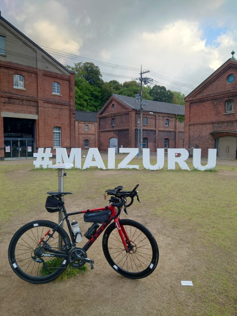
Congratulations to Shinji Kohara for setting the new record for Japan (Main Island) in these categories: Male, Unsupported, 18-49 Age Group, Standard Upright Bike.
1. Record Attempt
Honshu (Japan main island) S->N regional crossing
2. Name of Rider
Shinji Kohara
3. Start date and exact start time
April 27, 2025, 22:00
4. Exact Start location
Kangen Bridge, Shimonoseki, Yamaguchi Prefecture.
On Prefectural Route 250, ~1.5km SSW of Shimonoseki Station west exit, at the crossing of the small channel from Hikoshima to Honshu.
33.93875669749187 N, 130.9153073508708 E
33°56’19.5″N, 130°54’55.1″E
5. What were the conditions like?
Much of Japan tends to have the most comfortable weather during this season, and even the forecast right before the start predicted temperatures ranging from 11℃ to 25℃ across the route. However, during the night in the northern regions, especially along the coast and in the mountains, I experienced temperatures as low as 3℃.
Also, due to the large temperature fluctuations typical of this season, the
weather can be unstable. In this case, it rained continuously – though not heavily – from shortly after the start on the first day until just before reaching the day’s goal, despite there being no such forecast. Thankfully, since I started from the southern region, the temperature was still warm, which helped.
On the first half of the second day, I struggled with a headwind that made it hard to make progress. However, after that, I was often aided by crosswinds or tailwinds, and there was no rain, which created favorable conditions.
In the final 50 kilometers toward Oma Cape on the last day, I had a strong tailwind that allowed me to ride at a good speed, even though I was already exhausted.
Overall, I could feel the environmental changes that come with traveling such a long distance from south to north. Even at the same temperature, it felt significantly colder in the northern regions – possibly due to differences in humidity.
6. Why did you want to do a record?
I first learned about WUCA when I accompanied a Japan cross-country attempt as a driver last year.
At the time, I had this assumption that cross-country records were something to be measured through a Japan north-to-south ride, and since there was already a very fast record established for that, I believed it was something that had nothing to do with me.
The Japan cross-country attempt I supported as a driver successfully set a new record. While browsing the WUCA website to view that record, I happened to come across the record for the Honshu Traverse.
I’ve never been good at sports since I was a child. However, that didn’t mean I hated physical activity – I enjoyed it in my own way, even though I wasn’t very skilled.
Naturally, because I wasn’t good at it, the idea of setting a sports-related record had never crossed my mind.
But recently, I discovered that I could handle long-distance rides reasonably well. I completed the 2023 Paris-Brest-Paris, and in 2024, I finished a 1,200 km brevet in Uzbekistan. Those experiences gave me confidence that I could ride distances over 1,000 km.
Of course, there are many people faster than me in those events. But since there haven’t been many predecessors attempting the Honshu Traverse, I thought – maybe even someone like me, who never had a chance to set any kind of athletic record, could actually establish a new one. If I’m going to try, now’s the time! That was my motivation.
Additionally, the establishment of the Unsupported category was another major reason that pushed me to take on this challenge.
7. What Equipment did you use? Anything special?
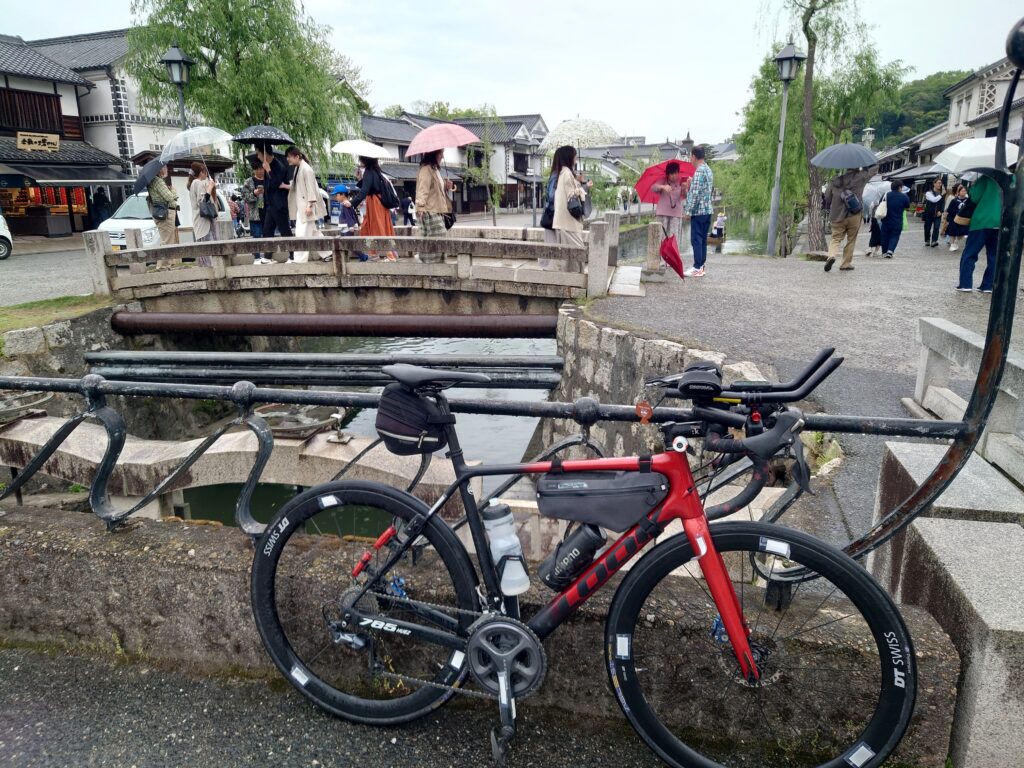
The frame I used was a LOOK 785 Huez, paired with DT Swiss CRC 1100 wheels and ULTEGRA 6800 components.
There’s no special reason behind this setup – the previous bike I owned was damaged, and the 785 Huez was the frame I chose to replace it. I simply reused the ULTEGRA 6800 components from the old bike. However, since this setup doesn’t support hydraulic brakes, I used GROWTAC’s EQUAL brakes instead.
As for the gearing, I used a standard 52-36 chainring in the front and an 11-30 cassette in the rear. This is my usual setup, and I didn’t make any changes specifically for this attempt.
For tires, I used the Panaracer AGILEST DURO, which I always rely on for brevets. They had already been ridden for around 3,600 km, but they made it through this challenge without any issues once again.
The only real modification I made for this attempt was adding DH bars. Rather than for aerodynamic benefits, the main purpose was to allow for multiple riding positions to help distribute fatigue. To make the position more comfortable, I also installed 50mm risers. This setup proved to be extremely useful during the ride.
8. What did you eat and drink.
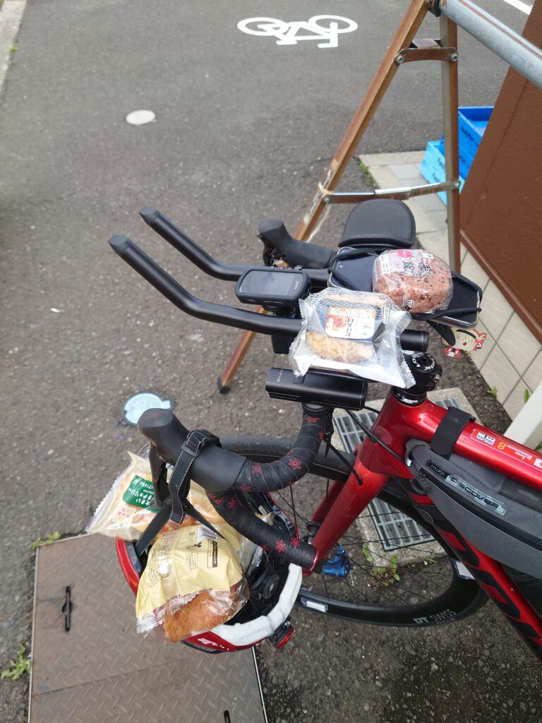
Except for two occasions, I primarily ate food purchased at convenience stores. My usual routine was to buy a few items to eat on the spot along with some to carry in my back pocket as ride fuel, then quickly get back on the road once I finished eating.
For on-the-spot meals, I mostly chose items like rice balls, sandwiches, and bread. When I was already feeling hungry, I often supplemented these with jelly-type energy drinks. Since carried food tends to be on the sweeter side, I also liked to eat things like curry bread or croquette-filled buns to balance it out.
As for portable snacks, I often relied on traditional Japanese sweets like dorayaki, chestnut manju, kintsuba, and yokan, along with items like danishes and cream-filled bread. I favored options that could be eaten in small portions.
Just before reaching my goal for the day, I would stop by a convenience store again to buy food for dinner at the lodging, something for breakfast the next morning, and ride fuel for the following day.
On one occasion, I departed later than planned, which happened to coincide with the time when breakfast was being served at my accommodation, so I decided to eat it.
For drinks, I stuck entirely to water. Since I only carried one bottle, I chose water because it could serve multiple purposes beyond hydration – such as rinsing a wound or cooling myself down by pouring it over my head in extreme heat.
To make up for the lack of sugars and electrolytes, I made sure to get enough of them through my meals.
9. What was the best part?
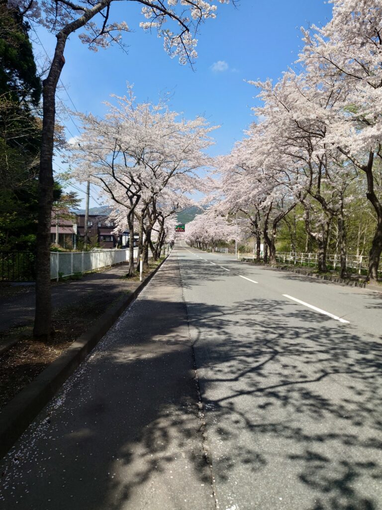
It might be more than just a “part,” but I’d say the coastal roads after entering the Tohoku region stood out the most.
From around that area, traffic along the coastline decreases, and if the weather is clear, you get to ride while taking in the vast ocean beside you and gazing down a seemingly endless shoreline ahead.
The scenery shifts dramatically from what you experience on the first and second days, which really makes you feel how far you’ve traveled – and at the same time, it brings the realization that the journey is nearing its end.
This year, cherry blossoms bloomed a bit later than usual, so on the final stretch toward Oma Cape, I passed through a tunnel of cherry trees in full bloom around Ohata. Not long after that, I caught my first glimpse of the finish point – Oma Cape – across the coastal horizon. The emotional impact of that moment is something I honestly can’t fully express in words.
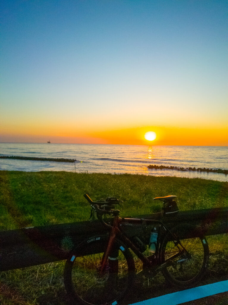
If I were to pick just one particularly memorable moment, it would be the sunset over the Sea of Japan that I witnessed in Murakami, Niigata Prefecture.
Living in Tokyo, I usually see the sun set behind mountains. But on the Sea of Japan side, the sun sets directly into the horizon. Of course, I’ve seen sunsets over the ocean several times before, but there had always been clouds along the horizon that obscured the view to some degree.
That day, however, the view was completely clear – nothing blocked my sight – and I saw a perfect red sun sinking straight into the ocean.
If I hadn’t needed to make it in time for my hotel check-in, I probably would’ve stayed there much longer, just watching it in awe.
10. What was the hardest part?
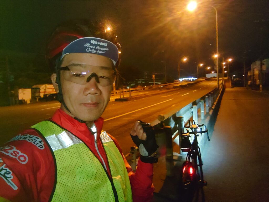
That would be the night of the third day. I was riding from Murakami in Niigata Prefecture toward Sakata in Yamagata Prefecture – a route that would typically offer a beautiful ride along the coastline. Unfortunately, according to my schedule, this section had to be ridden at night.
I had anticipated the nighttime riding, and based on the weather forecast I had checked beforehand, I expected a low of around 11℃. However, in reality, the temperature dropped to as low as 3℃. I was wearing gear suited for 11℃, so naturally, I ended up freezing.
Due to accumulated fatigue, I couldn’t generate enough power to warm myself up, so I had to ride the entire remaining 100 km to the lodging while shivering. On top of that, as I entered the late-night hours, sleepiness also started to hit me. To make matters worse, there were hardly any places to take shelter or rest along the way. It was an extremely tough stretch, both physically and mentally.
11. Did anything particularly unusual happen?
It was right after I finished the ride on Day 4 and saved the log on my Garmin device. When I opened Strava to review the ride, I was shocked to find that none of the map data had been recorded. All other data – such as distance and
elapsed time – was completely normal, but the GPS route itself was missing.
By that point, I had already ridden over 1,500 km and had only about 140 km left. Realizing that the log for this critical part of the ride was incomplete, I felt the strength drain from my entire body. In the Unsupported category, the GPS log is an essential piece of evidence. Without it, I feared that the entire record might not be accepted.
I had originally planned to reach my goal on Day 4, but due to the cold and feeling unwell, I had decided to stop early and check into a hotel. This logging issue on top of everything else left me feeling completely defeated, and for a moment, I seriously considered abandoning the attempt altogether.
But eventually, I managed to rally my spirits. No matter what the outcome would be, I resolved to see it through—and with that mindset, I pushed forward and completed the final day of the ride.
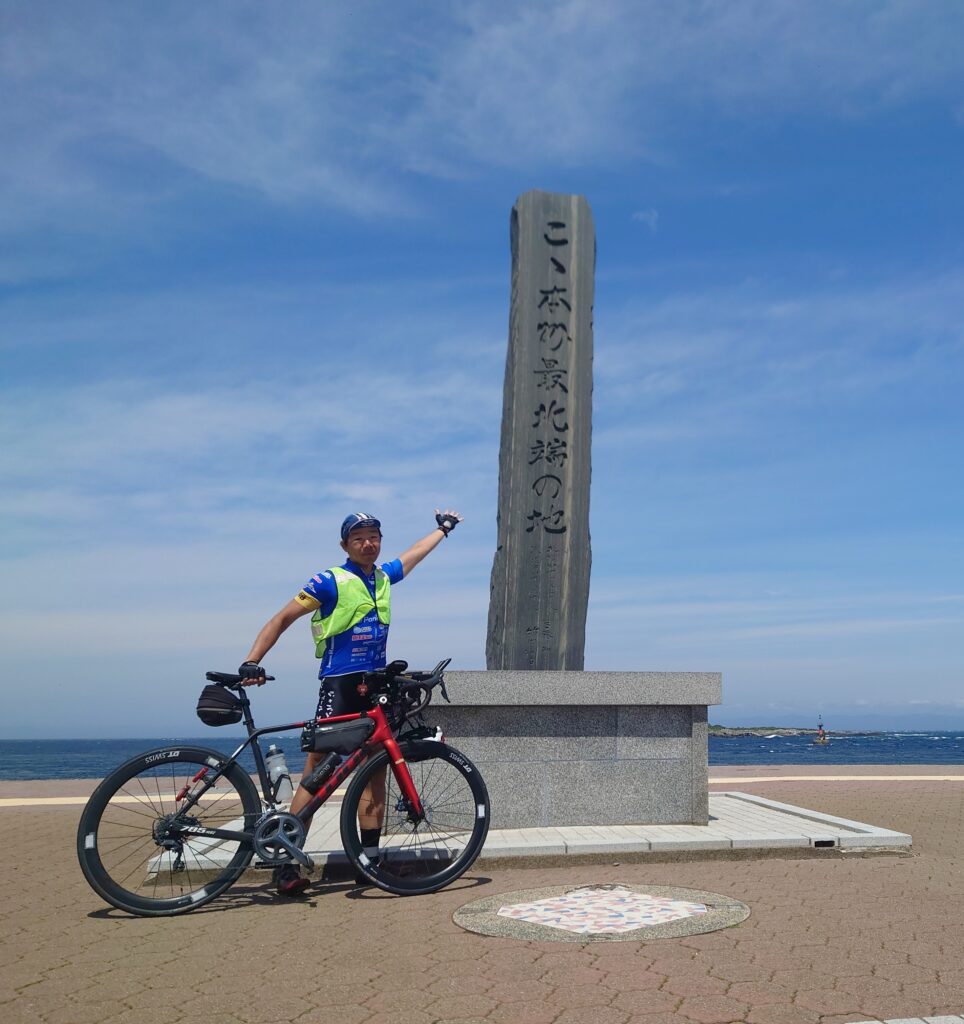
12. Exact finish Location
Cape Oma (Omazaki) in Aomori, at the monument identifying the northernmost point of Honshu.
41.54638705463183 N, 140.9126434005875 E
41°32’47.0″N, 140°54’45.5″E
https://goo.gl/maps/nfDpFmhkvPqLekLZ8
13. Exact finish time
May 2, 2025, 11:22